
Tongariro Maps, Distance and Breakdown
Often described as the best one-day hike in New Zealand, the Tongariro Alpine Crossing spans 20.2 kilometres and typically takes 6-8 hours to complete. This world-renowned alpine hike provides an opportunity to experience some of the most scenic and active volcanic terrain in Tongariro National Park.
Tongariro Alpine Crossing Section Breakdown
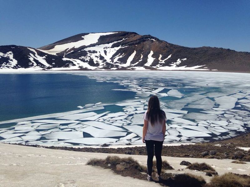
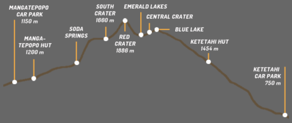
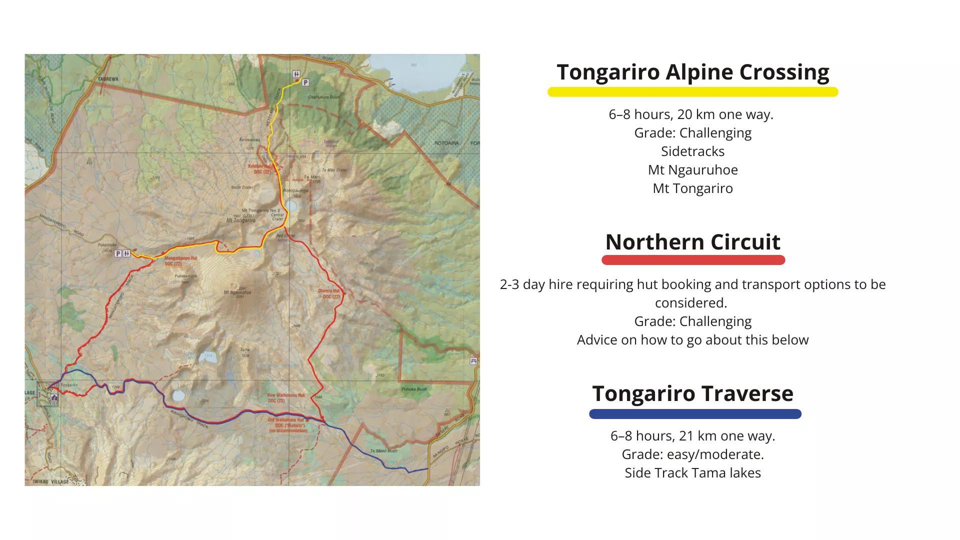
The track winds up the Mangatepopo Valley to the saddle between Mount Tongariro and Mount Ngauruhoe. From here, it climbs steadily to Red Crater at 1,886 metres - the highest point on the crossing. The trail then descends past the vivid Emerald Lakes, one of the crossing's most photographed features. After passing the Blue Lake, the track descends around the northern slope of Mount Tongariro before zig-zagging down to Ketetahi Hut. From the hut, the track continues down the mountain through tussock plains and into native forest, ending at the Ketetahi car park.
Approximate Walking Times
| Destination | Time |
|---|---|
| CAR PARK TO SODA SPRINGS | 1 HOUR |
| SODA SPRINGS TO SOUTH CRATER | 1 HOUR |
| SOUTH CRATER TO RED CRATER | 1 HOUR |
| EMERALD LAKES TO KETETAHI HUT | 2 HOURS |
| KETETAHI HUT TO CAR PARK | 2 HOURS |
Approximate Walking Times
Alternative Hikes in Tongariro National Park
Northern Circuit
This 43km, two to three day Great Walk circumnavigates Mount Ngauruhoe and includes the full Tongariro Alpine Crossing as part of the route. The track starts and finishes at Whakapapa Village, passing through diverse volcanic landscapes with hut accommodation available along the way. If you have your own vehicle, park at Whakapapa to complete the full loop. (Due to the wild fires of 2024, the section between Whakapapa to Mangatepopo is closed.)
Tongariro Traverse
Take a hike through Mordor of The Lord of the Rings. This is a full-day self-guided hike that traverses the Tongariro National Park from the extreme eastern boundary to the heart of the park at Whakapapa Village passing between the peaks of Mt Ngauruahoe (Mt Doom) and Mt Ruapehu.
Highlights along the way are the historic Waihohonui hut; the Tama lakes formed by old volcanic explosions, and the Taranaki Falls. At the end of the hike, if time permits, visit the Whakapapa Village visitors centre to see the history of the park, or the village tavern for a well-deserved break.
The hike itself is easy, with no steep ascents or descents and with great views.
This area of the park is less susceptible to the severe weather conditions that can be experienced at high altitudes on the crossing track - making it safer in marginal weather.
Tongariro National Park Hike Map
FAQs
How long does the Tongariro Alpine Crossing take?
Most hikers complete the 20.4km Tongariro Alpine Crossing in 6-8 hours. Your time will depend on your fitness level, weather conditions and how many photo stops you take!
What is the highest point on the Tongariro Alpine Crossing?
The highest point on the main track is Red Crater at 1,886 metres above sea level.
How much elevation gain is there?
The total elevation gain is approximately 800 metres from the Mangatepopo Car Park (1,120m) to Red Crater (1,886m). There's also significant descent of about 1,000 metres from Red Crater down to the Ketetahi end (760m).
What is the steepest section?
The Devil's Staircase is the steepest and most challenging climb, featuring a series of switchbacks that gain elevation quickly. The descent from Red Crater to the Emerald Lakes can also be tricky due to loose volcanic scree.
What is the terrain like on the Tongariro Alpine Crossing?
The terrain varies dramatically throughout the hike. You'll travel past ancient lava flows, volcanic scree, alpine meadows, and native forest. Expect boardwalks in the Mangatepopo Valley, rocky paths, the steep Devil's Staircase, loose scoria on the descent from Red Crater, and well-formed tracks through tussock and forest near the end.
Ready to book your Tongariro Alpine Shuttle?